Карта путеводителя:
Как добраться на общественном транспорте:
From Tbilisi
By bus from the capital's Didube Bus station. In Akhaltsikhe, they come to Tamarashvili Street, wh ere the local bus station is located. There are flights every 40-60 minutes, from 7:00 to 19:00, and the ticket costs 12 lari. The distance from Akhaltsikhe to Tbilisi is approximately 206 km, the travel time is 3-3.5 hours.
From Batumi
By shuttle bus, which departs from the old bus station, located on Mayakovsky Street, 1. There are only 2 direct flights per day: at 8:00 and at 10:30. The fare costs 20-25 GEL, the road lasts about 5.5-6 hours.
Старт:
Akhaltsikhe
Детали маршрута:
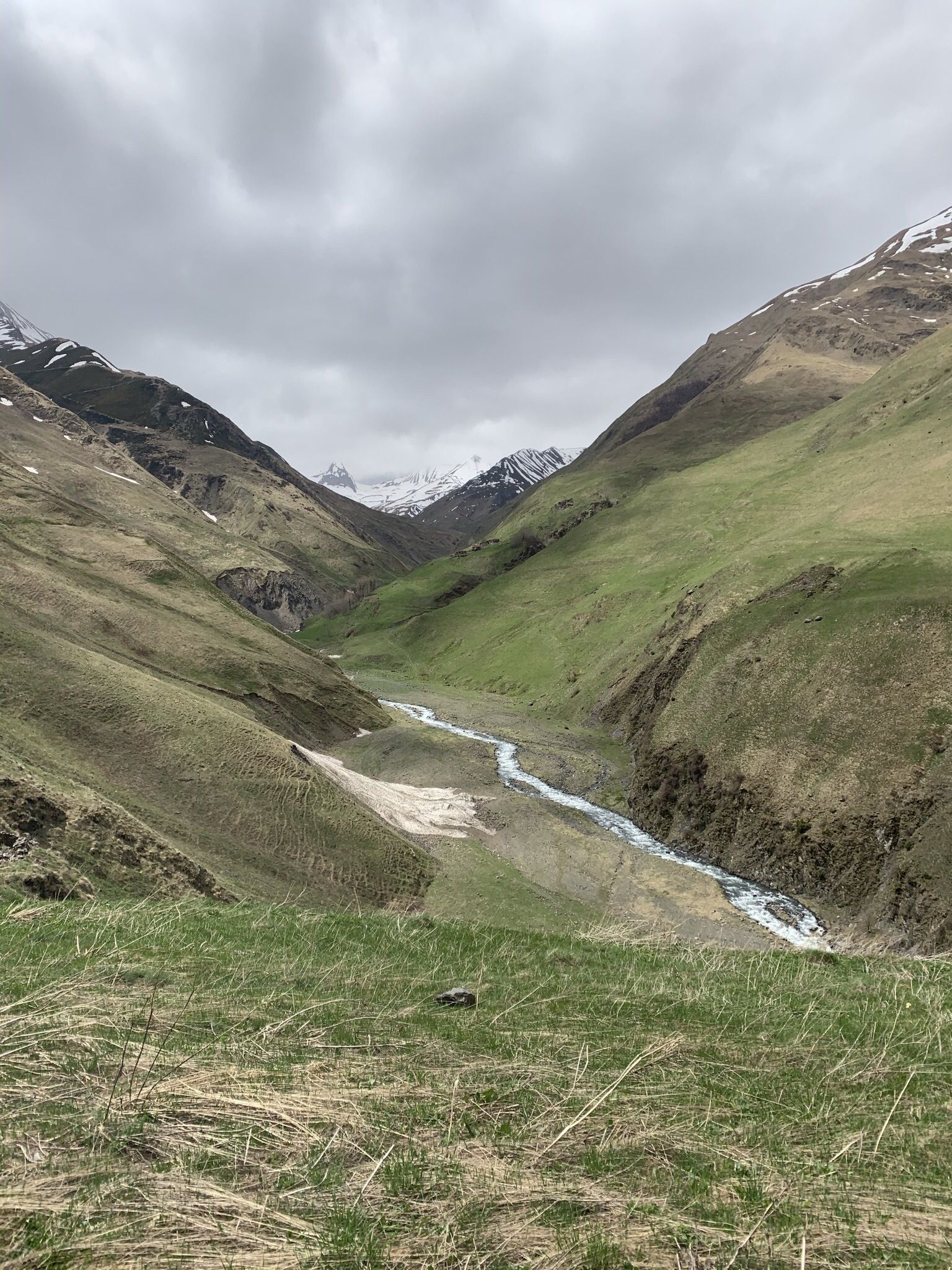
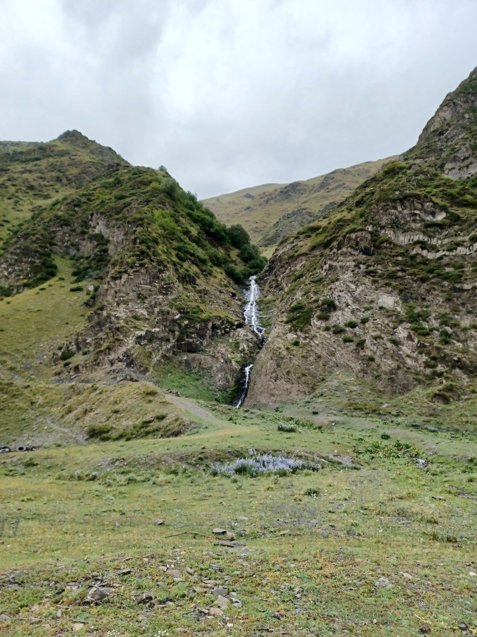
The gorge begins in the village of Akhaltsikhe (Sno gorge) and stretches along the riverbed of the Artkhmoskali. Here you can discover the ancient abandoned settlements of Miguda and Arthmo, as well as the most beautiful waterfalls. Akhaltsikhe is a small village located 10 km from the village of Stepantsminda.
The total route is about 10 kilometers, but there are a lot of impressions!
Финиш:
Akhaltsikhe
Что взять с собой:
Good shoes, water (several liters), a snack. Sportswear, according to the weather. A detailed description of the equipment is available in the full description of the route
The full route includes a GPS track and photos from places.
Полное описание:
Start in Akhaltsikhe (Sno gorge), go along the riverbed of the Artkhmoskali on the road. On the way back, we walk along the right side of the river and climb to the peak of 1.9 km . You can stop for a snack or even spend the night, if desired. We go down the same road as we went up
A complete list of necessary things for the hike
1. Clothing (according to the weather, indicated for the winter season / off-season)
Sneakers (trekking shoes)
Windbreaker (Windproof jacket with hood / Warm jacket)
Jacket (Sweater / Fleece jacket / Hooded Jacket)
T—shirt - 3 pcs. (thermal underwear)
Socks — 4 pairs
Ear Patch (Hat)
Sunglasses
Sunscreen / Face Protection Mask
Undershirt (mat with elastic belt for sitting on bivouac, rocks, ground)
Gloves — 2 pairs (thin fleece, warm waterproof and windproof)
windproof pants
2. Equipment
Backpack 15-30 l (for road and day trips)
Lantern
Mat (trapik, karemat)
Sleeping bag (winter)
MSBK (mug, spoon, bowl, knife)
Thermos
Trekking poles
3. Other
First aid kit (analgesic, antipyretic, bandage, iodine, alcohol, plasters, bandage for sprains)
Hygiene kit (towel, handkerchief, wet wipes, toilet paper, soap, toothbrush and paste)
Passport and medical center
Swimsuit for tanning
4. Life and food (if it is supposed to be in a tent)
Tent
Gas burner
Gas cylinders
Wire for hanging boilers
Boilers
The ladle
Can opener
Sponge, wire grater, detergent
Matches, dry alcohol, paper for ignition
Compass, GPS navigator
AA and AAA batteries
Awning for tents and equipment shelters
Cooking food (stew, buckwheat, bread, coffee)
Water (5-10 liters)


 Скачать маршрут GPX


 Поделиться

